|
|
|
|

|
|
What is IRIS?
The Irkutsk Regional Information System for Environmental Protection (IRIS) assesses the current status and dynamics of the Irkutsk region's forestry environment, influenced by man-made changes and anthropogenic impact. IRIS benefits and contributes to on-going European–Russian cooperation projects.
IRIS builds on former Framework Programme 4 and 5 projects, extends their networks to Russia and adopts some of their findings to the specific needs of the involved governmental agency. This implements for the first time that the scientific results from former EC-funded scientific co-operations are being collected and transformed to tools for regional management by the administration.
Coordination: Friedrich Schiller University Jena, Germany
Funding: European Commission, 6th Framework Programme (Specific Support Action)
Live time: July 2006 - July 2008
IRIS Web Services
IRIS aims to efficiently share up-to-date and long-term satellite-based Earth Observation (EO) data and socio-economic information within earth science community, regional governance and nature-protecting services to identify environmental impacts that are both economic and socially responsible.
Geoserver acts as OpenGIS-compliant web services layer on top of IRIS' data sources. OpenLayers (client) brings that maps into web browsers.
For more information visit the IRIS Maps Test Environment (very unfinished)!
|

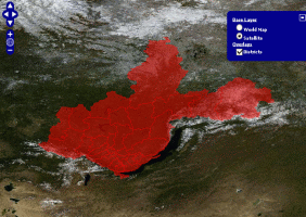
Irkutsk Region and Ust-Ordynsky Buryat Autonomous Area.
|
|


News
Web GIS Data Service Online >>
|
|
|
|
|

